Expert system for anti-air defense commander
Faculty of Informatics and Management UHK, Faculty of Science UHK
Project Description
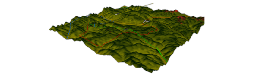
The optimal placement of selected air defense elements is computed for any given place on the Earth with a marked defended structure and selected air-raid routes. The map height profile is loaded from Google Maps API during a simulation initialization. The range and visible area for the given air-defense elements are computed on the basis of the height profile. Different placements of anti-air elements are tested. The success rate of air raid scenarios gives the optimal locations where to place such elements.
Detailed information
The aim of this project is to create an expert system for commanders of anti-air units which helps to plan the effective deployment of anti-air elements such as radars and firing equipment. Computer simulations enable the testing of different scenarios. Based on the preferred strategy, optimal placements of elements are found. Commanders can choose any place on the Earth to be examined. Firstly, the defended object is identified, then available resources to be deployed are set. The commander also sets presumed air-strike routes. Then simulations are run; they result in statistical evaluations of the situation and possible scenarios giving recommendations for optimal placements of anti-air elements.
Project supervisor
Section navigation: Topics
